Global warming and geography
Normal conditions
In a normal year, winds along the equator push warm water westward. Warm water at the surface of the ocean blows from South America to Indonesia. As the warm water moves west, cold water from the deep rises up to the surface. This cold water ends up on the coast of South America.
 
El Nino explained
Quite simply, El Nino is a set up when the warmer waters of the Pacific Ocean, near the equator, are blown towards South America and away from New Zealand and Australia. This creates a large area of warmer than average sea surface conditions in the eastern Pacific (we are south western) – this helps makes more lows which causes rain and floods for western areas of the Americas. But here in New Zealand and Australia the cooler ocean waters means we have less sub-tropical lows and more highs parked over the Tasman Sea.


La Nina explained
SO, WHAT IS LA NINA THEN?

The opposite of El Nino. It’s when that warm water gets blown westwards towards New Zealand and Fiji and Australia. We get more humidity, more rain and more tropical cyclones. La Nina often affects the North Island even more, as it’s exposed to the sub-tropical lows and high humidity. La Nina summers can be hot, humid but sometimes quite cloudy. La Nina can be wet for holidaymakers but good for dairy farmers.
 
Climate change impacts on El Nino

A new study finds that warming has come to influence the formation of El Niño.

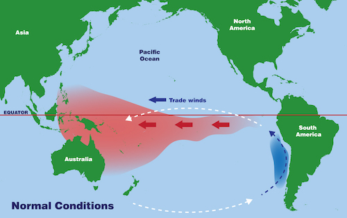
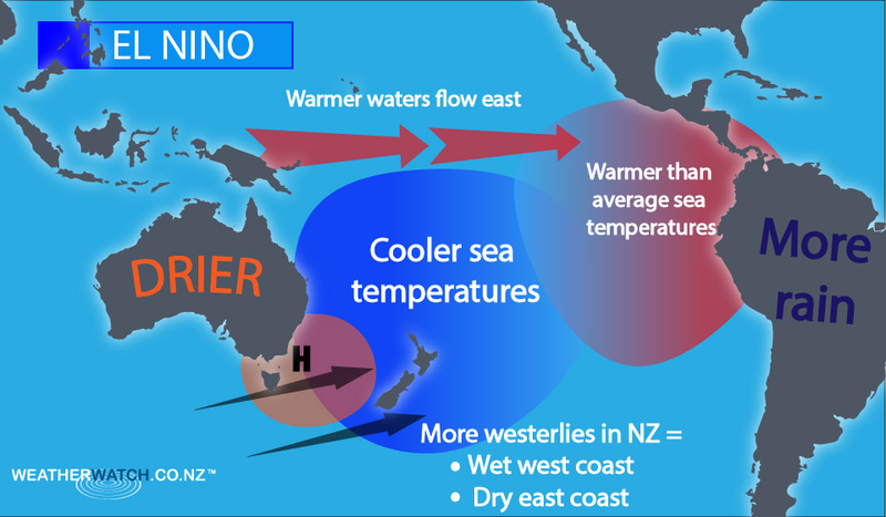
During El Niño, warm waters pool in the eastern Pacific and radiate heat into the air, leading to hotter weather across much of the globe. A strong El Niño is now taking shape and, according to NOAA, there is a 99 percent chance that 2023 will be the hottest year ever recorded.

The new study shows that, historically, there was a strong link between changes in solar output and the onset of El Niño, but now El Niño is more heavily influenced by human-caused warming.

For the research, scientists analyzed stalagmites collected from two caves on Alaska’s Prince of Wales Island. The stalagmites, formed by the slow, but varied drip of groundwater, serve as a record of the climate over the past 3,500 years, and indicate when El Niños took place.