Global warming and geography
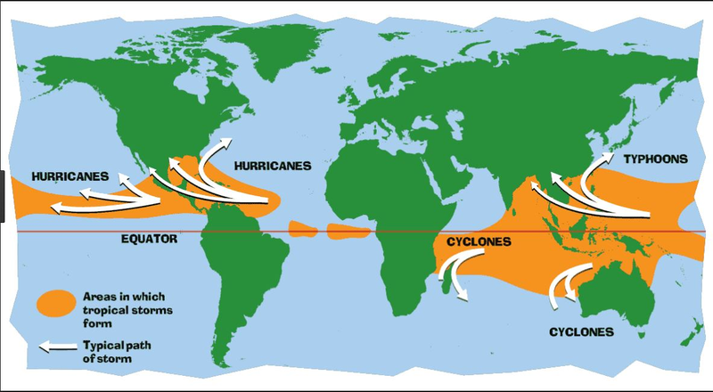
Map of major tropical storms

An Atlantic hurricane is a type of tropical cyclone that forms in the Atlantic Ocean primarily between June and November. [1]The terms "hurricane", "typhoon", and "cyclone" can be used interchangeably to describe this weather phenomenon. These storms are rotating, organized systems of clouds and thunderstorms that originate over tropical or subtropical waters and have closed low-level circulation, not to be confused with tornadoes. They form over low pressure systems. In the North Atlantic, central North Pacific, and eastern North Pacific, the term "hurricane" is mainly used, whereas "typhoon" is more commonly used for storms originating in the western North Pacific. The term "cyclone" is used in the South Pacific and Indian Ocean
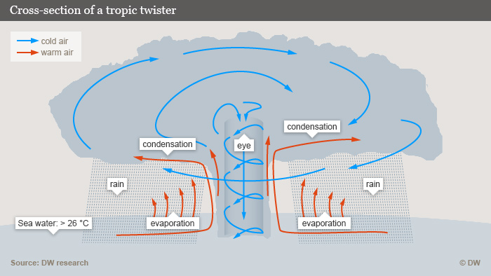
How do they form ?

A hurricane is a tropical storm with winds that have reached a constant speed of 74 miles per hour or more. The eye of a storm is usually 20-30 miles wide and may extend over 400 miles. The dangers of a storm include torrential rains, high winds and storm surges.
Impact of climate change

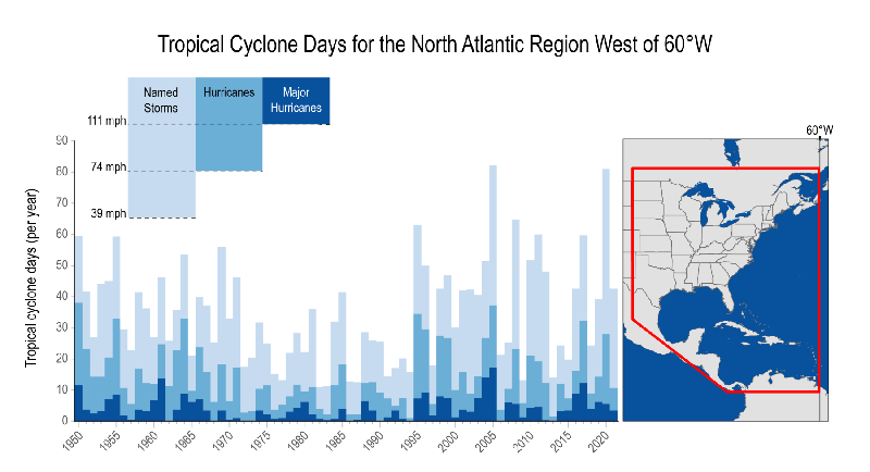
Multiple studies predict that the average number of tropical cyclones each season will remain steady or even decrease with climate change (see NCA4 Our Changing Climate: Changes in Severe Storms). However, warming sea surface temperatures due to increasing greenhouse gas concentrations are expected to make those storms more intense, which would increase the proportion of storms that become major hurricanes. We are beginning to detect these changes in the observational record, including in basins other than the Atlantic.